| |

|
County
Kilkenny from Samuel Lewis' Topographical
Directory of Ireland 1837
Kilkenny is sometimes referred
to as the the county of "The Three Sisters," referring
to the rivers
Barrow, Nore, and Suir, which flow toward Waterford Harbour. Much
of the centre and north of Kilkenny is drained by the Nore, which
then joins the Barrow. The Suir forms the southern boundary. The
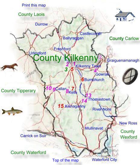
county is situated in the province of Leinster
Kilkenny City is the only large town in the county.
It is the main centre of services
and manufacturing. The lowest parts of Kilkenny lie on limestone.
They are mainly in the centre of the county and along its southern
and northwestern edges..
The Castlecomer plateau in the
northeast rises above the surrounding countryside and consists of
sandstone and shale. Kilkenny is bounded by Laois to the north,
Carlow and Wexford to the east, Waterford to the south, and Tipperary
to the west. Kilkenny measures 70 kilometers from north to south,
and 40 kilometers from east to west, and has a total land area of
2,062 sq. km (796 sq. miles) |
|
Agriculture was once the major industry,
farms average about 30 hectares (74 Acres) which is more than in
any other Irish county. Beef and Dairy farming are the two main
types of farming, arable crops such as Barley, potatoes, sugar beet,
and wheat are grown on most of the county with the exception of
the Castlecomer plateau, which is more suited to pastoral farming
particularly sheep. Some of the upland areas are given over to forestry.
Read about farming
in County Kilkenny in 1837
One fifth of Kilkenny's population is employed
in manufacturing, much of of which is located in and around Kilkenny
City. Food processing is a major employer, brewing and light engineering
are also significant employers. The processing of dairy products
is the principal food industry, with the largest plant at Ballyragget.
Approximately 70 per cent of the population live in rural areas.
About half of the working population of County Kilkenny are employed
in the service industries. Of which retail and wholesale distribution
are the main categories, other services include catering, education,
health, public administration, and transport. Kilkenny was once
known for polished dark limestone known as black marble, which was
quarried in the County.
Five members of parliament represent Kilkenny
and Carlow together in Dail Eireann. The county council City is
responsible for local government administration. The city also has
a borough corporation. Two national primary roads (N9 and N10) and
a railway cross the County from north to south. They link Dublin
and Waterford. There is a major port in the south near Waterford.
Many famous people are connected with Kilkenny.
They include the great Irish military leader of the 1640's Owen
Roe O'Neill. The writers George Berkeley was born in the county,
and George Farquhar and Jonathan
Swift both of whom were educated there
Shee Alms House
Rose Inn Street
Kilkenny
Co Kilkenny
Tel +353 (0)56 775 1500
Fax +353 (0)56 7763955
E Mail
Web
Site |
Kilkenny
once formed much of the Gaelic kingdom of Ossory, one of its
kings, Donal MacGillapatrick, founded the Cistercian abbey
of Jerpoint near Thomastown in the 1100's
In 1366 the Statutes
of Kilkenny, were passed these were an unsuccessful attempt
to prevent the integration of the Anglo-Normans and the Irish.
In 1642, the city was the seat of the Confederation
of Kilkenny, an alliance of old Irish and Anglo-Irish
Catholic families.
Read about Co
Kilkenny up to 1837 |
|
|
|