|
|
|
|

|
|
Welcome to Google map of County Louth |
Sell almost anything here.
|

| Businesses
in County Louth
listed with us. |
||||||||
Agriculture employs only about one-tenth of the population, the farmland of Louth is varied and suited to a wide variety of uses. More than one-fifth of it grows arable crops, mainly barley, oats, potatoes, and wheat. Most farms are mixed, with beef cattle production and dairying as the leading livestock enterprises. Sheep are reared on the Cooley Mountains. About 30% of the population work in manufacturing. Most of the industries are in Dundalk and Drogheda. Dundalk has brewing, clothing, engineering, footwear, meat, and tobacco industries. In Drogheda there are varied food processing, light engineering, and clothing industries. Service industries account for more than half the employment. A regional technical college in Dundalk serves the northeast of the Irish Republic. Louth sends four Td's to Dail Eireann, the county is administered mainly by a county council based in Dundalk. Read about the history of County Louth and information about the county from Samuel Lewis' Topographical Directory of Ireland published in 1837.
|
||||||||
|
|
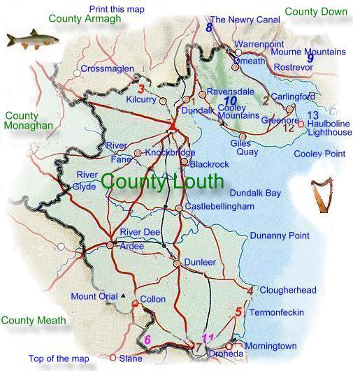
 the
smallest of Irelands counties, it is bounded on the North
by County Armagh, to the Northwest by County Monaghan, to
the South lies County Meath and to the East by the Irish Sea.
The name is said to have come from the river Lud. Its two
major towns are Dundalk and
the
smallest of Irelands counties, it is bounded on the North
by County Armagh, to the Northwest by County Monaghan, to
the South lies County Meath and to the East by the Irish Sea.
The name is said to have come from the river Lud. Its two
major towns are Dundalk and  lowland, rising to hills in the southwest. The only mountainous
area is the picturesque Carlingford Peninsula in the north, these
mountains are sometimes known as the Cooley Mountains and are associated
with many of Irelands
lowland, rising to hills in the southwest. The only mountainous
area is the picturesque Carlingford Peninsula in the north, these
mountains are sometimes known as the Cooley Mountains and are associated
with many of Irelands 
Map
of County Louth. |
|||||||
|
|||||||
|
|
Google
Map of County Louth |
||
|
|
||
|
|
|
Beauty
| Bridal |
Eat Out | Equestrian | Estate
Agents | Events | Fishing
| Florists | Guest
| Hotels | Jewelers
Museums | Music | Photographers | Self Catering | Taxi | Travel Agents | Wedding Transport |
| |
|