| |
|
| Read
about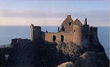 County Antrim towns from the Belfast
and Ulster Towns Directory 1910.
County Antrim from Samuel Lewis' Topographical
Directory of Ireland 1837
County Antrim from George
Bassett 1888
Sketches of Olden Days in Northern Ireland
by Rev. Hugh Forde Dunluce
Castle and Dunseverick
Castle
The Glens of Antrim.
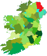
County Antrim is situated in the north
eastern corner of Ireland, it has an area of 972 Sq. Miles
(622,000 Acres) (3,046 square kilometer) it is bordered
to the north by the Atlantic and east by the North Channel
(Northern part of the Irish sea), and to the west the river
Bann forms the county boundary with Co Londonderry. Lough
Neagh (The largest fresh water lake in the UK and Ireland)
forms the rest of its western boundary from Toome at the north
of the lake where the Upper Bann leaves the Lough for the
sea at Coleraine. To the south it has a county boundary with
Co Down and Belfast Lough.
|
|
Most of the 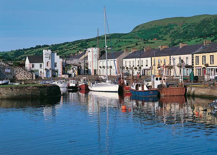 county
is a high, basalt plateau, The plateau is about 80 kilometer in length
and 50 wide. The beautiful Antrim coast road is built on a raised beach
at the foot of the high basalt cliffs. The Antrim plateau is cut by valleys
known as the nine Glens of Antrim.
These valleys, which run eastward to the sea, were formed by glaciers
in ancient times. The cliffs of Fair Head mark the Northeast corner of
the basalt block. At the Giant's Causeway, the outflow from a volcano
formed into about 40,00 pillars of black basalt, legend attributed this
to a giant Finn McCool
Most of the plateau is flat. Its highest point are at Trostan 554
metres (1,817 ft) above sea level, followed by Knocklayd at 517 metres
(1,695 ft) county
is a high, basalt plateau, The plateau is about 80 kilometer in length
and 50 wide. The beautiful Antrim coast road is built on a raised beach
at the foot of the high basalt cliffs. The Antrim plateau is cut by valleys
known as the nine Glens of Antrim.
These valleys, which run eastward to the sea, were formed by glaciers
in ancient times. The cliffs of Fair Head mark the Northeast corner of
the basalt block. At the Giant's Causeway, the outflow from a volcano
formed into about 40,00 pillars of black basalt, legend attributed this
to a giant Finn McCool
Most of the plateau is flat. Its highest point are at Trostan 554
metres (1,817 ft) above sea level, followed by Knocklayd at 517 metres
(1,695 ft)
Along Antrim's eastern
and northern  coasts
are many harbour's some cleft from the rock, from one of these it's said,
Deirdre (Of the
sorrows) and the sons of Uisneach embarked for Scotland to escape
the wrath of King Conor. coasts
are many harbour's some cleft from the rock, from one of these it's said,
Deirdre (Of the
sorrows) and the sons of Uisneach embarked for Scotland to escape
the wrath of King Conor.
At the top right 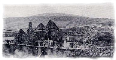 hand
corner of the county Fair Head stands proud above the sea, overlooking
Murlough bay and giving a birds eye view of Rathlin
Island. hand
corner of the county Fair Head stands proud above the sea, overlooking
Murlough bay and giving a birds eye view of Rathlin
Island.
Agriculture is the main industry.
Barley, oats, and potatoes are the main crops. But livestock production
is more important. Farmers in the county raise cattle, sheep, pigs, and
poultry. The textile industry was once important, chiefly for linen and,
more recently, synthetic fibers. This industry is now in decline.
Coal mines at Ballycastle were worked
until recently. Lignite (brown coal) is found in large quantities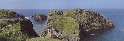 in the
county, although there is much opposition to its extraction. Most of Northern
Ireland's electricity is generated by stations at Ballylumford and Kilroot.
Iron ore and limestone were mined up until the 1970's. in the
county, although there is much opposition to its extraction. Most of Northern
Ireland's electricity is generated by stations at Ballylumford and Kilroot.
Iron ore and limestone were mined up until the 1970's.
Read about industries in County Antrim
from Samuel Lewis; Topographical
Directory of Ireland published in 1837.
The town of Antrim situated close
to the Northeast corner of Lough Neagh ,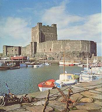 the largest inland lake in the United Kingdom and Ireland. Antrim and
Ballymena are the administrative centers of their respective districts.
The government has named them as new towns, which are centers for rapid,
industrial, and urban development. Larne is also an industrial center,
it is the main port for ferry traffic to and from the rest of the United
Kingdom. The smaller port of Carrickfergus is dominated by its great Norman
castle. Portrush and Portstewart are popular seaside resorts on the
Atlantic coast. Ballycastle
looks across a narrow sound (channel of water) to Rathlin Island. The
traditional Lammas fair is held at Ballycastle every August. Bushmills
is famous for its whiskey distillation.
Northern Ireland's main air and sea
terminals are located in the county of Antrim. Belfast International Airport
is at Aldergrove, The ferry port of
Larne, serving the short sea route to Stranraer, in Scotland, handles
most of Northern Ireland's freight traffic, the remainder is carried from
Warrenpoint in Co Down. The county has a good network of main roads. The
M2 motorway connects Belfast with Larne, with the airport, and with all
the main routes to the north and west. The railway links Belfast to Larne
and to Antrim, Ballymena, and Derry in the north.
The principal towns of the county
are Antrim, Belfast (Capital
of N I .) Ballycastle, Ballymoney,
Ballymena, Carrickfergus
and Lisburn. The county
has a population in excess of 250,000
Ballymena Tourist
Office
76 Church Street
Ballymena
BT 43 6DF
Co Antrim
E Mail
Web Site
|
|
|
|